New York City
Is New York City ready for the next Superstorm Sandy?
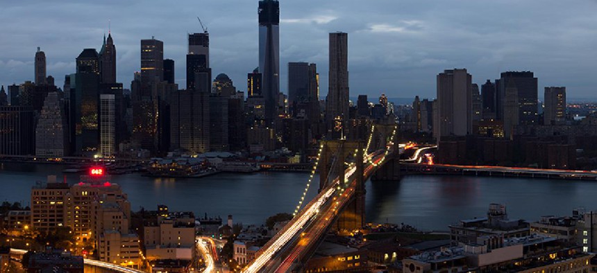
Reggie Lavoie / Shutterstock

On Oct. 29, 2012, the lights went out in lower Manhattan. Nearly every building south of the Empire State Building went dark after churning flood waters filled Con Edison substations and an explosion lit the sky on East 13th Street. Subway tunnels flooded. Low-lying neighborhoods from the Rockaways to the Financial District were inundated. Across the city, nearly 2 million people lost power and more than 300,000 homes, 23,000 businesses and nearly a half million city dwellers were in flooded areas. A total of 51 square miles of New York City, 17 percent of the city’s landmass, was underwater. Statewide, authorities tallied 53 deaths and $32 billion in damage from the storm.
Experts have since advocated for a wide range of solutions to future storm surges – some calling for massive floodgates to wall off New York Harbor, others investing in waterproofing projects that accommodate flooding and still others stressing the need to plan for a slow retreat from low-lying communities.
Yet the investments made so far by New York’s political leaders have ultimately been short-term solutions for the long-term problem of rising sea levels and increasingly violent storms due to climate change, several prominent earth scientists told City & State. And while improved emergency planning and the many miles of rebuilt coastlines with natural and man-made barriers would lessen the effects of another Superstorm Sandy today, experts said, five years later, with tens of billions of dollars invested, we are only marginally better protected than we were in 2012.
RELATED: Tracking the status of Superstorm Sandy resiliency projects
“By and large, there would be some improvement over the Sandy situation, but fundamentally we are still almost as vulnerable as we were before,” said Klaus Jacob, a geophysicist who predicted the subway flooding before Sandy. “Except for all the operational preparedness.”
On that last point, government officials and scientists agree. In the event of another massive storm, the city’s emergency response, from flood maps to evacuation plans, has improved and would likely save lives.
But so far, government plans to keep the public out of harm’s way in the first place have been twofold: physical storm barriers to block or slow down floodwaters, and what amounts to waterproofing.

Streets of Brooklyn are flooded after Superstorm Sandy. (Shutterstock)
New York City, which bore the brunt of Sandy’s effects in the state along with Long Island, has invested its $23 billion resiliency budget in a raft of projects across four areas: coastal defenses, critical infrastructure, social and economic resiliency, and buildings upgrades. A total of $17.75 billion is in ongoing or completed projects, $5.25 billion has been spent and the remaining $5.25 billion has been allocated to specific resiliency projects that have not yet started.
Daniel Zarrilli, New York City’s chief resilience officer who oversees those projects, notes that while the city’s efforts are still underway, it is making progress.
“We’re in this middle timeframe where we are now building a lot of things,” Zarrilli said. “But we continue to get safer every day with the projects we do finish, and continue to move forward with every bit of urgency that we can bring to this.”
Zarrilli’s office highlighted the completed 5.5-mile storm-hardened Rockaway Boardwalk, ongoing construction on a wetlands renewal projects in Midland Beach, a jettylike structure off the private community of Sea Gate and final designs for a levee project disguised as a park on the Lower East Side. All are signs of important progress to help deflect storm surge, he said, at a total cost of $1.13 billion. As of the most recent report in April 2017, about 17 percent of all coastal defense projects were marked complete.
RELATED: How much longer can politicians ignore climate change?
In terms of critical infrastructure, the city’s Office of Recovery and Resiliency noted upgrades designed to help the city’s water, power and health care systems better weather another inundation, including a hardened third water tunnel to Staten Island, floodproofing for Con Edison’s steam, electric and natural gas distribution lines as well as hospital improvements in Brooklyn, Manhattan and Roosevelt Island at a total cost of $2.95 billion.
On the policy front, 16 changes made to the city building code in 2013 required new structures to be built with flood-resistant features, although the mayor’s office could not provide a number of how many buildings have been built to the new specifications.
“There is no one solution or quick fix to solve ... these climate challenges. With these updates, we can say we are a safer and more informed NYC today than we were when Sandy hit.” –New York City Chief Resilience Officer Daniel Zarrilli
The Metropolitan Transportation Authority, which suffered $5 billion in damage to the subway system alone from Sandy, committed $751 million systemwide to resiliency projects in 2016, with another $800 million likely to be spent on flood mitigation for the New York City Transit yards out of its total $3 billion resiliency budget. But the effort to waterproof, or effectively plug the holes that caused flooding to portions of the city’s 665 miles of subterranean tracks, is little more than “very good Band-Aids,” Jacob said. As the man who accurately predicted the flooding of the tunnels before Sandy, he notes that those efforts will help for only a few more decades.
The Army Corps of Engineers, armed with $3.5 billion in congressional funding in 2013, highlighted its vast effort to repair damaged Long Island shorelines stretching more than 100 miles from Rockaway to Montauk, adding sand dunes and jettylike structures to prevent beach erosion. These federal projects typically work with the state Department of Environmental Conservation and local authorities to get the work done.
But amid a flurry of city, state and federal projects, “tracking doesn’t seem to be a huge priority” for New York City, noted Steven Cohen, executive director of Columbia University’s Earth Institute. “I think there is a lot of public relations and politicking, and you rarely see hard data.”


The "Big U" proposal would ring lower Manhattan with a low-lying buffer zone that would protect the island's infrastructure in the event of severe flooding.
Zarrilli contended that his office regularly reports on their efforts. “We publish an annual progress report that goes down a litany of 157 things we laid out,” Zarrilli said, and also cited an online map that highlights the status of each resiliency project in the city. “It’s very fair that working in such a visible place, we can probably never get to the point of overcommunicating, but we intend and I think we follow through on being very transparent.”
“There is no one solution or quick fix to solve ... these climate challenges,” Zarrilli continued, but “with these updates, we can say we are a safer and more informed NYC today than we were when Sandy hit.”
RELATED: Learning from Hurricane Harvey and Superstorm Sandy
The most mammoth public works project envisioned to protect the region is a titanic sea wall stretching five miles across the mouth of New York Harbor from Breezy Point to Sandy Hook, New Jersey. A system of floodgates would remain open for shipping traffic, but close for storm surges, walling off New York Harbor. Other iterations propose a set of gates at the Verrazano-Narrows Bridge, East River and Arthur Kill. The Corps is still studying the possibility of such floodgates.
Such imaginative and grand concepts are still far from implementation. In some cases, there is a lack of scientific research to prove the concept and a lack of political will to drive it forward – as in the case of the harbor storm barrier. But in other cases, there is political will, but no solid proof it will work – or if it does work, that it will work for very long.
A team at Columbia University recently received funding to study whether a storm barrier, like placing one near the Verrazano-Narrows Bridge, would have the intended effect, but also whether a currently funded and progressing project called the “Big U” (left), a set of levees and storm barriers ringing the southern tip of Manhattan, would even work. The Lower East Side levee project is a segment of that project.
Kyle Mandli, a computational mathematician on that Columbia team – “give me a set of storms and I’ll tell you where the water goes” – is considering whether unintended consequences might make those major efforts unwise. Would the Big U worsen flooding in Brooklyn or would the outer harbor storm barrier push a larger storm surge into Long Island? And there’s the question of how high you build that barrier, he said: At any given height, will it be effective for 50 years, 100 years, 200 years?
“We’re just at the cusp of trying to answer whether that’s a good idea or not,” Mandli said. “Is it really going to protect to the point that the billions of dollars that it’s going to take to build the thing is worthwhile.”
But some neighborhood advocates, with traumatic memories of Sandy still front of mind, are more interested in action than plodding deliberation.
Catherine Hughes, who was a Community Board 1 member for two decades in lower Manhattan and is now a volunteer member of the New York-New Jersey Metropolitan Storm Surge Working Group. She’s hoping to protect her neighborhood from future floods. Even as a community board member, she supported the Corps’ study of storm surge barriers and organized a boat tour with experts to drum up support for the concept.
RELATED: Lessons from Superstorm Sandy have largely gone ignored
After a year of planning, there still isn’t any clarity on what exactly is planned for the east side of lower Manhattan’s segment of the Big U. “There are a couple proposals for the South Street Seaport, which is a couple blocks long,” she said. “Nothing for FiDi, which is over a mile long – and, it’s underfunded.”
Hughes is in favor of a massive harbor storm barrier as well.
“If you go to London, they have one in the Thames River, they have one in St. Petersburg, they have one in Venice,” she said. “So it would be a comprehensive approach to addressing sea level rise and storm surge and would give New York City another 100 years.”
But scientists are looking even further down the road and worry about a false sense of security that would come from building a barrier that will only last a limited amount of time, until rising sea levels would require the gates to be permanently shut with drastic environmental consequences.
The only true solution to the oceans rising around us is to move to higher ground where possible, Jacob said. “In terms of long-term urban and land use planning,” he said, “we have a big void that we have to fill sooner rather than later.”